Related products

Innomar ISE Processing Software (Rental)
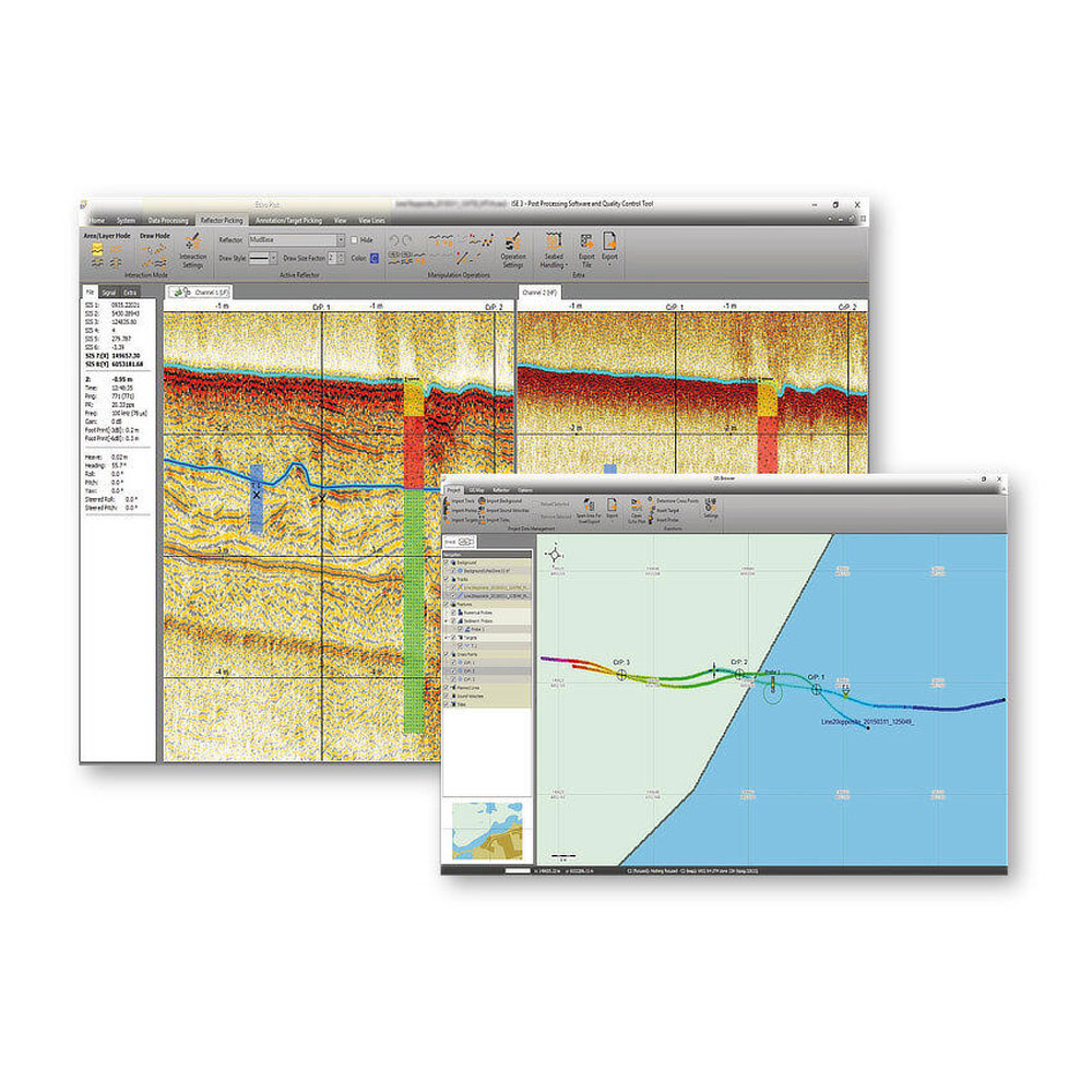
Overview
- Processing of all Innomar data formats, including SES3 files.
- Handling of 16/24/32-bit and multi-channel data files.
- Similar “look’n’feel” as the Innomar SESWIN on-line control and data acquisition software.
- Intuitive handling of 2D data sections with free zoom levels and undo/redo.
- Project-based workflow, but can also be used to view/process single data files.
- Integrated GIS-browser builds the file handling base.
- GIS map synchronized with seismic section view (cursor, track cross-points, picked targets and ground-truth positions).
- Processed and interpreted data can be exported into various industry-standard data formats, including ASCII, DXF, 3D grids.
Description
Post-processing software with GIS module for Innomar specific data files.
Innomar ISE is the user-friendly post-processing software for all data acquired by Innomar’s parametric sub-bottom profilers.
A project-based workflow allows intuitive handling of 2D seismic sections together with a GIS map window. The processing includes signal filtering, noise reduction, tide and vertical corrections, cleaning of external sensor data, picking of seabed and sub-seabed reflectors and targets and the overlay of external probe and core data to assist interpretation.
Raw, processed and interpreted data can be exported to various industry-standard formats, such as SEG-Y, XTF and ASCII
Project-based Workflow
- Project tree with all files, such as seismic data sections, tide files, ground-truth data, picked leayers and targets, etc.
- Save/restore the processing status for individual data files and projects between sessions.
GIS Browser
- Handling of data in various coordinate systems and projections.
- Overlay of colour-coded bathymetry, sub-bottom layers, targets and ground-truthing onto charts, geo-referenced images and other GIS data.
- Calculation of crossing points between tracks and marking these positions in the 2D sections to assist quality assurance.
Processing of 2D Seismic Sections
- Processing of full-waveform and envelope data.
- Several visualisation modes and colour-mapping options.
- Various noise and spike removal filters.
- Options to correct gain, such as time-variable gain (TVG) and automatic gain control (AGC).
- Different options for (semi-) automatic bottom track.
- Corrections for vessel movements (heave, roll, pitch), tide/swell, static shifts and sound velocity.
- Picking and export of acoustic reflections from layers and targets.
CONTACT INFO
Have a question? Can’t find what you’re looking for? We’d love to hear from you!
Connect with us using the information below.
PHONE
+1 706-522-3022
ADDRESS
481 S. Jackson Street
Hartwell, GA 30643
Hartwell, GA 30643
At ECHO81, we believe in the power of collaboration and are proud to work alongside a network of exceptional partners who share our commitment to excellence. We work with EdgeTech, Kongsberg, Applanix, AML Oceanographic, and many more.
We are always looking for new ways to grow and improve. If you have any questions, feedback, or would like to learn more about how ECHO81 can assist you, please don’t hesitate to Contact Us