-
 HYPACK WATER QUALITY MAPPING: is the software for environmental sensor (water quality and velocity) data collection and processing. The WATER QUALITY MAPPING license includes support for various water quality sensors (up to 32 parameters), acoustic Doppler current profilers (ADCPs) and basic bathymetric mapping.
 -
HYPACK GEOPHYSICS combines all of the tools required for geophysical surveys in a centralized, easy to use interface. GEOPHYSICS supports side scan, sub-bottom and magnetometer survey planning, navigation, and processing, including interfaces for more than 30 devices. GEOPHYSICS includes search and recovery (SAR) survey and targeting tools. Collect and mosaic side scan data in real-time or in postprocessing.
-
 HYPACK VIPER: Visualization of environmental sensor data. Choose from over 50 sensor variables and view them in profile, gradient or spreadsheet view.
 -
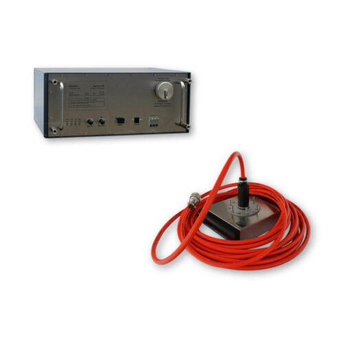
 Impact Subsea ISFMD System ROV Only System ROV Only System
 -
 Impact Subsea ISFMD System Software License
 -
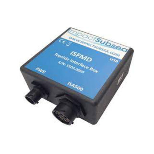 Impact Subsea ISFMD System Topside Interface Box
 -
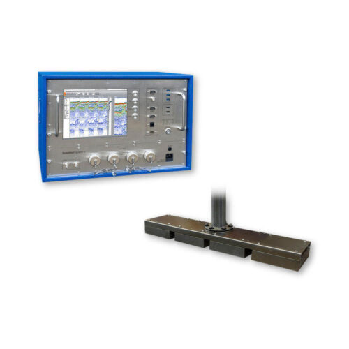
Included Features
- Roll or Pitch beam stabilization
- 24-bit SLF full waveform data acquisition / Innomar "SES3" data format
- Multi-ping mode for maintaining a high pulse rate in deep waters
- Multi-frequency signals
- LFM chirp (5 – 15 kHz)
- SESWIN basic remote-control via COM / UDP (e.g. line start/stop, line name)
- external AC power adapter (100–240 V AC)
-
Included Features
- Heave / Roll (or Pitch) beam stabilization
- 16-bit SLF full waveform data acquisition (sub-bottom data) / Innomar "RAW" data format
- 24-bit SLF full waveform data acquisition / Innomar "SES3" data format
- Multi-ping mode for maintaining a high pulse rate in deep waters
- Multi-frequency signals
- LFM chirp (5 – 15 kHz)
- SESWIN basic remote-control via COM / UDP (e.g. line start/stop, line name)
-
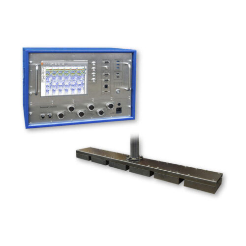
Included Features
- Heave, Roll and Pitch beam stabilization
- 24-bit SLF full waveform data acquisition / Innomar "SES3" data format
- Multi-ping mode for maintaining a high pulse rate in deep waters
- Multi-frequency signals
- LFM chirp (full SLF band)
- Barker coded pulses for safe bottom track also in multi-ping modes
- Linear sub-bottom profiler / SBES echosounder mode (12/15/18 kHz CW and 12 – 18 kHz FM chirp pulses)
- Bottom slope control
- KVM extender for remote control
- SESWIN basic remote-control via COM / UDP (e.g. line start/stop, line name)
- Transducer frame with integrated shock absorbers for hull-mounting
-
Included Features
- Heave / Roll (or Pitch) beam stabilization
- 16-bit SLF full waveform data acquisition (sub-bottom data) / Innomar "RAW" data format
- 24-bit SLF full waveform data acquisition / Innomar "SES3" data format
- Multi-ping mode for maintaining a high pulse rate in deep waters
- Multi-frequency signals
- LFM chirp (5 – 15 kHz)
- SESWIN basic remote-control via COM / UDP (e.g. line start/stop, line name)
- external AC power adapter (100–240 V AC)
-
Included Features
- 24-bit SLF full waveform data acquisition / Innomar "SES3" data format
- Multi-ping mode for maintaining a high pulse rate in deep waters
- Multi-frequency signals
- SESWIN basic remote-control via COM / UDP (e.g. line start/stop, line name)
-
Included Features
- 24-bit SLF full waveform data acquisition / Innomar "SES3" data format
- Multi-ping mode for maintaining a high pulse rate in deep waters
- Multi-frequency signals
- SESWIN basic remote-control via COM / UDP (e.g. line start/stop, line name)
Contact us at +1 (706) 522-3022
TOP NEWS!
481 S. Jackson Street
Hartwell, GA 30643
Shop
Your account
Subscribe to our newsletter.
Join our emailing list to receive all up-to-date information from ECHO81