-
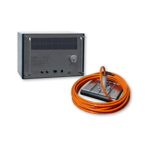
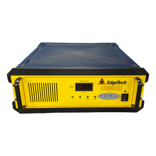 EdgeTech Starmux IV Interface Digital Interface for use with EdgeTech 4205/2050 Series towfish and customer supplied PC Full version of DISCOVER software available for customer download
 -
 Subscription or Perpetual based license
 -
 Subscription or Perpetual based license
 -
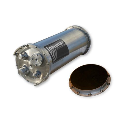
Included Features
- 24-bit SLF full waveform data acquisition / Innomar "SES3" data format
- Multi-ping mode for maintaining a high pulse rate in deep waters
- Multi-frequency signals
- SESWIN basic remote-control via COM / UDP (e.g. line start/stop, line name)
-
Included Features
- Heave / Roll (or Pitch) beam stabilization
- 16-bit SLF full waveform data acquisition (sub-bottom data) / Innomar "RAW" data format
- 24-bit SLF full waveform data acquisition / Innomar "SES3" data format
- Multi-ping mode for maintaining a high pulse rate in deep waters
- Multi-frequency signals
- LFM chirp (5 – 15 kHz)
- SESWIN basic remote-control via COM / UDP (e.g. line start/stop, line name)
- external AC power adapter (100–240 V AC)
-
Included Features
- Heave, Roll and Pitch beam stabilization
- 24-bit SLF full waveform data acquisition / Innomar "SES3" data format
- Multi-ping mode for maintaining a high pulse rate in deep waters
- Multi-frequency signals
- LFM chirp (full SLF band)
- Barker coded pulses for safe bottom track also in multi-ping modes
- Linear sub-bottom profiler / SBES echosounder mode (12/15/18 kHz CW and 12 – 18 kHz FM chirp pulses)
- Bottom slope control
- KVM extender for remote control
- SESWIN basic remote-control via COM / UDP (e.g. line start/stop, line name)
- Transducer frame with integrated shock absorbers for hull-mounting
-
Included Features
- Heave / Roll (or Pitch) beam stabilization
- 16-bit SLF full waveform data acquisition (sub-bottom data) / Innomar "RAW" data format
- 24-bit SLF full waveform data acquisition / Innomar "SES3" data format
- Multi-ping mode for maintaining a high pulse rate in deep waters
- Multi-frequency signals
- LFM chirp (5 – 15 kHz)
- SESWIN basic remote-control via COM / UDP (e.g. line start/stop, line name)
-
Included Features
- Roll or Pitch beam stabilization
- 24-bit SLF full waveform data acquisition / Innomar "SES3" data format
- Multi-ping mode for maintaining a high pulse rate in deep waters
- Multi-frequency signals
- LFM chirp (5 – 15 kHz)
- SESWIN basic remote-control via COM / UDP (e.g. line start/stop, line name)
- external AC power adapter (100–240 V AC)
-
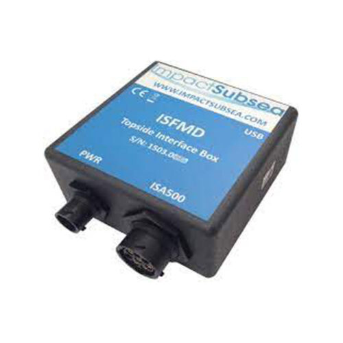 Impact Subsea ISFMD System Topside Interface Box
 -
 Impact Subsea ISFMD System Software License
 -
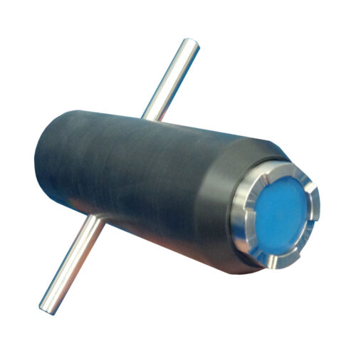 Impact Subsea ISFMD System ROV Only System ROV Only System
 -
 HYPACK VIPER: Visualization of environmental sensor data. Choose from over 50 sensor variables and view them in profile, gradient or spreadsheet view.
 -
 HYPACK GEOPHYSICS combines all of the tools required for geophysical surveys in a centralized, easy to use interface. GEOPHYSICS supports side scan, sub-bottom and magnetometer survey planning, navigation, and processing, including interfaces for more than 30 devices. GEOPHYSICS includes search and recovery (SAR) survey and targeting tools. Collect and mosaic side scan data in real-time or in postprocessing.
 -
HYPACK WATER QUALITY MAPPING: is the software for environmental sensor (water quality and velocity) data collection and processing. The WATER QUALITY MAPPING license includes support for various water quality sensors (up to 32 parameters), acoustic Doppler current profilers (ADCPs) and basic bathymetric mapping.
-
 HYPACK OFFICE: is the survey data processing and final products version of HYPACK MAX. It supports processing and final products, from any survey data collected with MAX (excludes multibeam and LiDAR.
 -
 HYSWEEP is the module for planning, collection, and processing of multibeam, backscatter, LiDAR, and water column data. HYSWEEP requires a HYPACK (SURVEY or MAX) license for data collection. The SURVEY or MAX license can be upgraded to support multibeam and LiDAR by adding the HYSWEEP? module.
 -
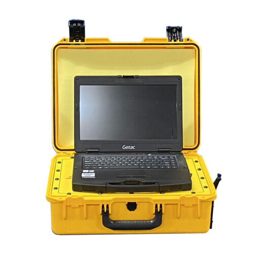 EdgeTech Laptop
 -
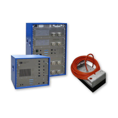
EdgeTech Topside Processor With Starmux IV Interface 19" rack mountable StarMux IV Digital Interface 19" rack mountable Processor PC with EdgeTech's DISCOVER Software for data acquisition and replay Dual LCD Monitors, Keyboard & Trackball Technical Manual and Ruggedized Shipping Crate
-
 Applanix POSPac Go! with other options available
 -
 Applanix Extended POS MV warranty products: Extended POS MV f/w & POSView s/w warranty per year
 -
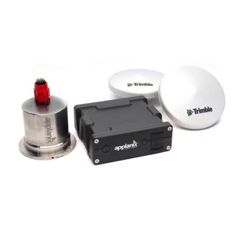 Maximize your ROI with Applanix® POS MV WaveMaster. WaveMaster is a user friendly, turnkey system designed and built to provide accurate attitude, heading, heave, position, and velocity data of your marine vessel and onboard sensors. Applanix POS MV blends GNSS data with angular rate and acceleration data from an IMU and heading from GNSS Azimuth Measurement System (GAMS) to produce a robust and accurate full six degrees of freedom Position and Orientation solution. All Applanix POS MV models are designed for use with multibeam sonar systems, enabling adherence to IHO (International Hydrographic Survey) standards on sonar swath widths of greater than ± 75 degrees under all dynamic conditions.
 -
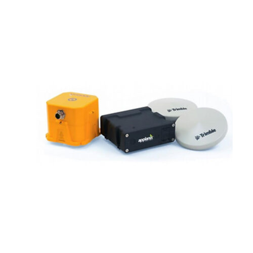
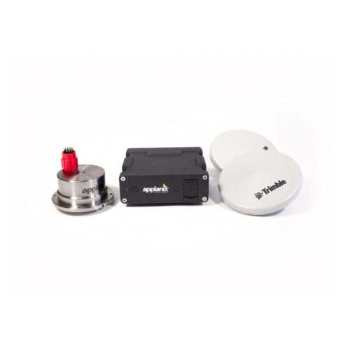 Maximize your ROI with Applanix® POS MV SurfMaster. SurfMaster is a user‑friendly, turnkey system designed and built to provide accurate attitude, heading, heave, position, and velocity data of your marine vessel and onboard sensors. Applanix POS MV blends GNSS data with angular rate and acceleration data from an IMU and heading from GNSS Azimuth Measurement System (GAMS) to produce a robust and accurate full six degrees of freedom Position and Orientation solution. All Applanix POS MV models are designed for use with multibeam sonar systems, enabling adherence to IHO (International Hydrographic Survey) standards on sonar swath widths of greater than ± 75 degrees under all dynamic conditions.
 -
Maximize your ROI with Applanix® POS MV SurfMaster. SurfMaster is a user‑friendly, turnkey system designed and built to provide accurate attitude, heading, heave, position, and velocity data of your marine vessel and onboard sensors. Applanix POS MV blends GNSS data with angular rate and acceleration data from an IMU and heading from GNSS Azimuth Measurement System (GAMS) to produce a robust and accurate full six degrees of freedom Position and Orientation solution. All Applanix POS MV models are designed for use with multibeam sonar systems, enabling adherence to IHO (International Hydrographic Survey) standards on sonar swath widths of greater than ± 75 degrees under all dynamic conditions.
Contact us at +1 (706) 522-3022
TOP NEWS!
481 S. Jackson Street
Hartwell, GA 30643
Shop
Your account
Stay Connected
Explore the latest updates, product releases, and subsea technology insights from ECHO81.