- Fugro MarineStar, Monthly, Coastal
- Fugro MarineStar, Monthly, Regional
- Fugro MarineStar, Yearly, Coastal
- Fugro MarineStar, Yearly, Coastal Inland
- Fugro MarineStar, Yearly, Regional
- Fugro MarineStar,Monthly, Coastal Inland
-
 Fugro MarineStar Subscription available with the following options:
 -
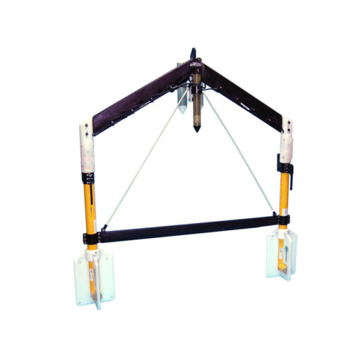 G882 TVG Transverse Gradiometer to supply a fiberglass transverse wing and two G882 cesium vapor magnetometers, altimeter, and depth (pressure) sensor supplied with 60V Deck Power Supply Junction box, 150-meters of soft tow cable, tool kit, serial cable, USB-to-Serial adapter, power supply, USB drive with Geometrics configuration software and user manuals, and transit cases.
 -
G882 TVG Transverse Gradiometer Equipment rental to supply a fiberglass transverse wing and two G882 cesium vapor magnetometers, altimeter, and depth (pressure) sensor supplied with 60V Deck Power Supply Junction box, 150-meters of soft tow cable, tool kit, serial cable, USB-to-Serial adapter, power supply, USB drive with Geometrics configuration software and user manuals, and transit cases.
-
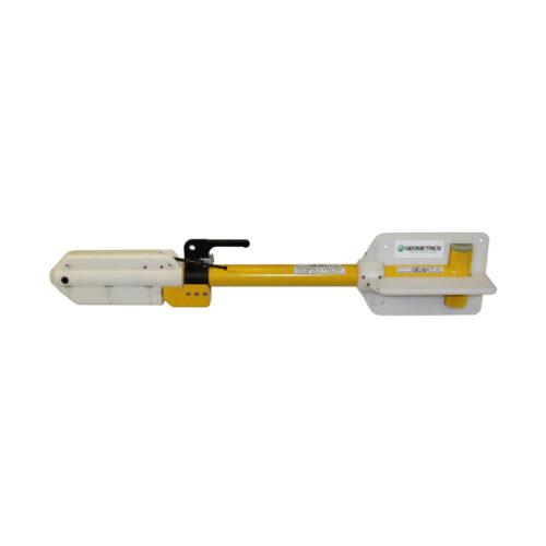 Geometrics G882 Magnetometer (w/ 250 PSI pressure sensor and 500 kHz Altimeter). Comes with junction box, RS232 serial comms cable, AC power kit, DC power kit, and shipping crate.
 -
Geometrics G882 Magnetometer (w/ 250 PSI pressure sensor and 500 kHz Altimeter) Equipment rental to supply an underwater towed magnetometer system with pressure sensor and 500 kHz altimeter. Comes with junction box, RS232 serial comms cable, AC power kit, DC power kit, and shipping crate.
-
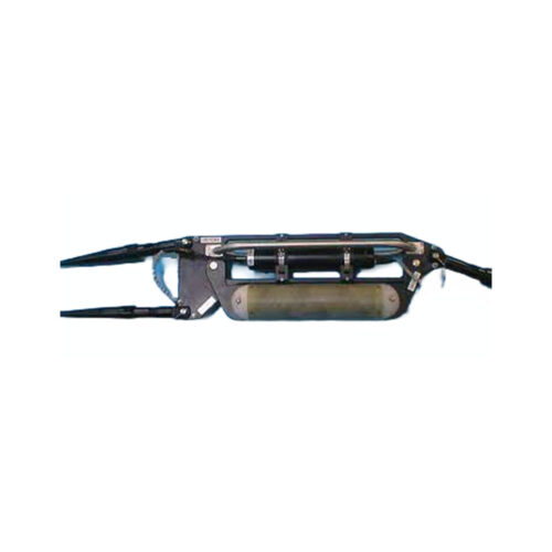
Geometrics G882 Tandem Tow Kit Comes with EdgeTech 4205 Tow Key, 9-meter umbilical, and interface kit.
-
Geometrics G882 Tandem Tow Kit Equipment rental comes with EdgeTech 4205 Tow Key, 9-meter umbilical, and interface kit.
-
 Geometrics Telemetry MUX Equipment to supply telemetry bottle, topside power supply, and 15m deck cable
 -
Geometrics Telemetry MUX Equipment rental to supply telemetry bottle, topside power supply, and 15m deck cable
-
Geometrics TVG Frame (Frame Only) Equipment rental to supply a fiberglass transverse wing
-
Geometrics TVG Frame (Frame Only) Equipment rental to supply a fiberglass transverse wing
-
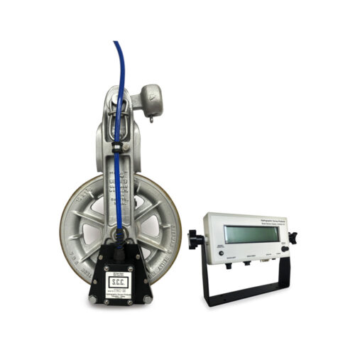 HSP 22" Sheave Counter Comes with remote display, accessory kit, 100-ft deck cable, and reusable transit case.