-
 HYPACK LITE: is the data collection and processing software for all the sensors supported by SURVEY. LITE includes data collection aspects from SURVEY, with the addition of processing tools for the same sensor suite. The data products from LITE can be exported to CAD or GIS.
 -
Included Features
- Heave / Roll beam stabilization
- 24-bit SLF full waveform data acquisition / Innomar "SES3" data format
- Multi-ping mode for maintaining a high pulse rate in deep waters
- Multi-frequency signals
- LFM chirp (3 – 12 kHz)
- KVM extender for remote control
- SESWIN basic remote-control via COM / UDP (e.g. line start/stop, line name)
- Transducer frame with integrated shock absorbers for hull-mounting
-
 Subscription or Perpetual based license
 -
 Subscription or Perpetual based license
 -
- Option for integrated OEM Inertial Navigation System
- 4th generation MPES (Multi-Phase) technology
- Co-registered simultaneous dual frequency side scan data
- Bathymetry data which is IHO SP-44 Special Order compliant
- Gap-fill side scan sonar and bathymetry data
- Bathymetry backscatter data
- Motion Tolerant side scan data
- Swath sectors of up to 200° means far shorter time for data collection
- Optimized Bathymetry modes: Equidistant and Equiangular
- EdgeTech’s Discover Bathymetric control software
- Integrated sound velocity sensor
- Unrivaled swath coverage and resolution in shallow water when compared to other MBES or PDBS sonar.
-
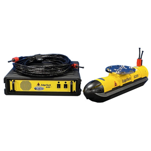
 EdgeTech 2205 Tri-Frequency SSS & 2-16 SBP (ROV) 2k Depth Rating Equipment rental to supply a Combined EdgeTech 2205 SS & SBP System designed for ROVs and AUVs. Comes with bottle electronics, side scan sonar arrays, sub-bottom transducer and PVDF receiver arrays, Discover software, and mounting brackets.
 -
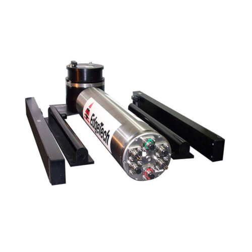
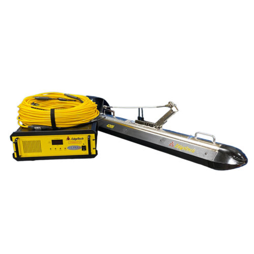 Equipment rental to supply 4205 MP/MT Side Scan Sonar enabled with Magnetometer Interface and comes with Side Scan Sonar motion tolerant configuration with multi-pulse. Frequencies of 540/850 kHz. Comes with Starmux IV rack mountable topside interface, 15-meter winch deck cable, 15-meter on-deck test cable, AC power cord, and Ethernet cable.
 -
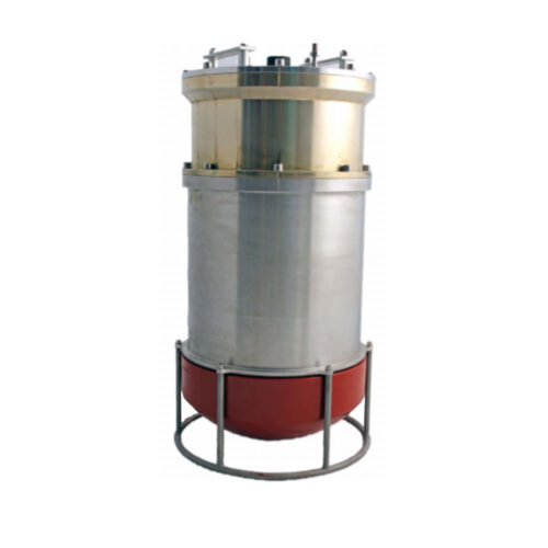
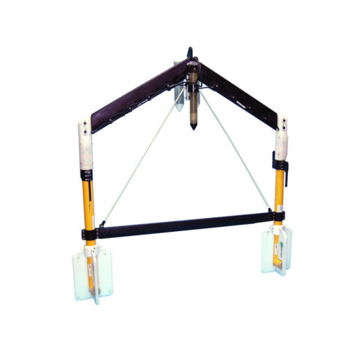 Geometrics TVG Frame (Frame Only) Equipment rental to supply a fiberglass transverse wing
 -
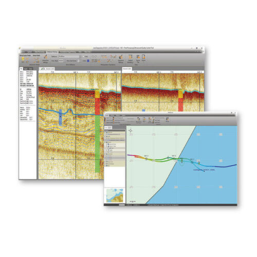
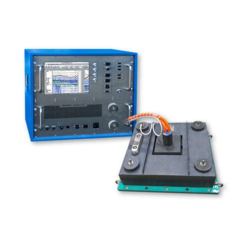
Overview
- Processing of all Innomar data formats, including SES3 files.
- Handling of 16/24/32-bit and multi-channel data files.
- Similar "look'n'feel" as the Innomar SESWIN on-line control and data acquisition software.
- Intuitive handling of 2D data sections with free zoom levels and undo/redo.
- Project-based workflow, but can also be used to view/process single data files.
- Integrated GIS-browser builds the file handling base.
- GIS map synchronized with seismic section view (cursor, track cross-points, picked targets and ground-truth positions).
- Processed and interpreted data can be exported into various industry-standard data formats, including ASCII, DXF, 3D grids.
-
 USM Compact OTS Pole Mount Equipment rental to supply a USM Compact Over-the-Side (OTS) Pole Mount System. Comes with Compact base with shear block assembly, 5-ft x 3.5-in Z-pole, storage angle bracket, 3-ft cheater bar, and mounting hardware. **Weld down plate sold separately and is a consumable item as it will be permanently affixed to the vessel. **VOOP kit may also be used for non permanent installations
 -
 Kongsberg 352P MGC R3 USBL System Portable system designed for tracking ROV's, towfish, divers and other subsea objects at several thousand meters range. The system operates in SSBL mode where it measures the distance and direction to subsea transponders and computes a 3D position in local coordinates or in geographical coordinates. Built-in MGC RT inertial measurement unit for roll/pitch and heading compensation. No need for calibration to determine roll, pitch and heading alignments.
 -
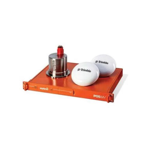 Maximize your ROI with Applanix® POS MV OceanMaster. OceanMaster is a user-friendly, turnkey system designed and built to provide accurate attitude, heading, heave, position, and velocity data of your marine vessel and onboard sensors. Applanix POS MV blends GNSS data with angular rate and acceleration data from an IMU and heading from GNSS Azimuth Measurement System (GAMS) to produce a robust and accurate full six degrees of freedom Position and Orientation solution. All Applanix POS MV models are designed for use with multibeam sonar systems, enabling adherence to IHO (International Hydrographic Survey) standards on sonar swath widths of greater than ± 75 degrees under all dynamic conditions.
Contact us at +1 (706) 522-3022
TOP NEWS!
481 S. Jackson Street
Hartwell, GA 30643
Shop
Your account
Stay Connected
Explore the latest updates, product releases, and subsea technology insights from ECHO81.