-
 HYPACK SURVEY HYPACK SURVEY: is the data collection-only software, where editing and final products are being handled by other means. It has no editing or final product tools. SURVEY supports survey mission planning, navigation, and data acquisition from various sensors, except multi beam and LiDAR devices.
 -
 DREDGEPACK: is the complete dredging solution. This license enables control of cutter suction, hopper, excavator, and bucket dredge operations. Improve efficiency and monitor the digging operations with DREDGEPACK, providing the design tools to accurately model almost any dredge plan. This license is not for hydrographic surveying.
 -
 EdgeTech 2300 Combined Tri-Frequency Side Scan Sonar 230/540/850 kHz With 540 kHz 3D Bathy & High Resolution Sub-Bottom Profiler Towfish Towfish with 230/540/850 kHz side scan sonar Tri-Frequency Transducers with 540 kHz bathymetry with capability to display and record any two Side Scan Sonar Frequencies simultaneously on command via Discover Software Sub-Bottom Profiler comprises Four (4) 1-10 kHz CHIRP Transducers with high sensitivity PVDF Receive Array provide a focused, narrow beam pattern for superior imagery 2,000m Depth Rating Towfish also includes a depth sensor, magnetometer interface and SBG Ellipse Pitch, Roll & Heading Sensor An ROV interface (48v dc power in, and ethernet comms) connection is available allowing direct communications with a customer's Mux Includes 15m Test Cable, Technical Manual, Accessory Kit, and Shipping Crate
 -
 This over-the-side configuration is designed to be pole-mounted off the side of a vessel. It consists of a dual 1-10 kHz transducer and PVDF receiver array configuration. It provides for deeper water operations than the towed 3400 Sub-Bottom profilers. This type does support an amplifier option.
 -
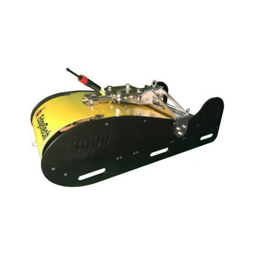 EdgeTech ASSY Top 3400 Combined Towed And Pole Mounted Sonar Head Model 3400 Digital Towfish with Removable Pole Mount Attachment Dual 2-16 kHz Chirp Transmitters Large Multichannel Receiver Array Motion, Depth & Heave Sensors Dual Frequency Transmission Pipeline Survey Mode User selectable Pulses
 -
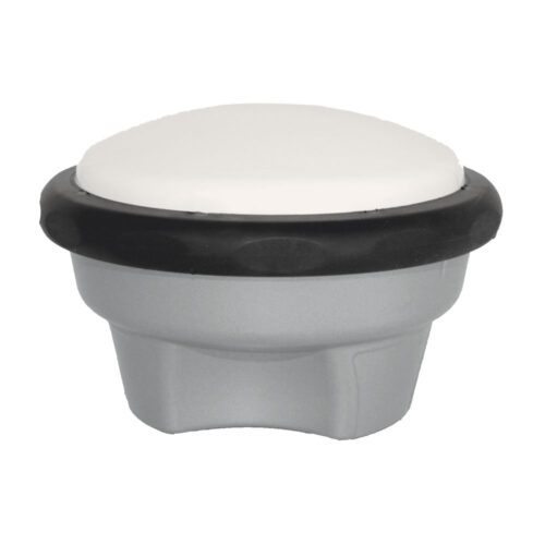 Applanix GNSS antenna, GA830
 -
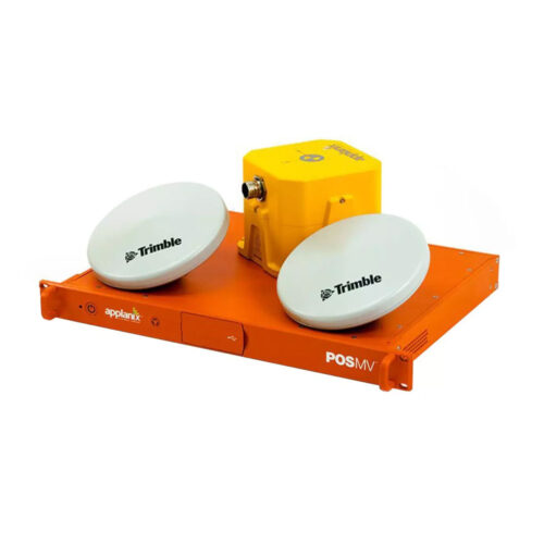 Applanix RTK POS MV OceanMaster RM Key Features:
- 0.01° roll and pitch performance
- IN-Fusion™ 2.0 ensures optimal GNSS aiding for any given conditions
- TrueHeave™ - no requirement to tune filter for specific conditions, no settling time so no run in time
- High accuracy inertial measurement units featuring SmartCal™
- Data time tagged to microsecond accuracy
-
 Global Service Open Anywhere
 -
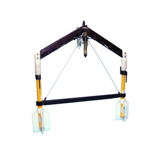
 USM HighTower Bow Mount USM HighTower Bow Mount. Comes with HighTower base assembly with gear drive and shear block, 8-ft x 4.5" Z-foil, storage angle bracket, 3-ft cheater bar and mounting hardware. **Weld down plate sold separately and is a consumable item as it will be permanently affixed to the vessel.
 -
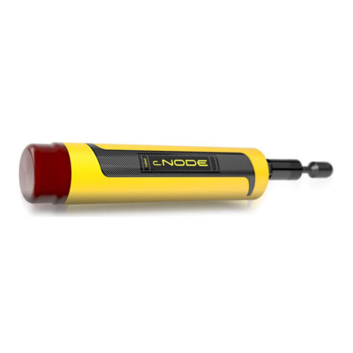 Kongsberg cNODE Micro 31-180 Beacon Equipment rental to supply a cNODE? Micro transponder. Small and light enough to be used by divers and shallow water ROV's. Comes with pressure sensor rated to 600m, charging kit and transit case.
 -
 Kongsberg uPAP 200-NEL Portable System Equipment rental to supply the uPAP 200-NEL Portable system designed for tracking ROV's, towfish, divers and other subsea objects at several thousand meters range. Comes with portable operator unit, uPAP 200-NEL transducer, 25m cable, APOS base version for uPAP, and instruction manual.
 -
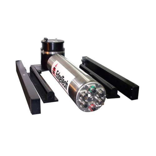
 Geometrics Telemetry MUX Equipment to supply telemetry bottle, topside power supply, and 15m deck cable
 -
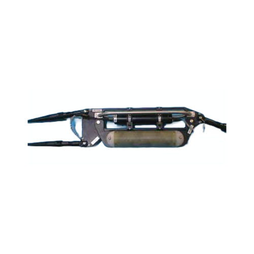
 G882 TVG Transverse Gradiometer to supply a fiberglass transverse wing and two G882 cesium vapor magnetometers, altimeter, and depth (pressure) sensor supplied with 60V Deck Power Supply Junction box, 150-meters of soft tow cable, tool kit, serial cable, USB-to-Serial adapter, power supply, USB drive with Geometrics configuration software and user manuals, and transit cases.
 -
 EdgeTech 2K Rated 2205 Side Scan Sonar System designed for ROVs and AUVs. Comes with bottle electronics, side scan sonar arrays, Discover software, and mounting brackets.
 -
 • Fully integrated turnkey system • Tri-Frequency Side Scan Sonar & Sub-Bottom Profiler • Digital telemetry over single coaxial tow cable • Choice of side scan frequencies • Built-in Pressure (Depth) Heading, Heave, Pitch and Roll sensors
 -
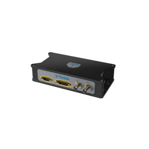 Trimble BX992 The Trimble BX992 was designed for easy integration and rugged dependability. Customers benefit from the Ethernet connectivity available on the board, allowing high speed data transfer and configuration via standard web browsers. USB, CAN and RS‑232 are also supported. Just like other Trimble embedded technologies, easy to use software commands simplify integration and reduce development times.
 -
Kongsberg uPAP 200-NEL Portable System Equipment rental to supply the uPAP 200-NEL Portable system designed for tracking ROV's, towfish, divers and other subsea objects at several thousand meters range. Comes with portable operator unit, uPAP 200-NEL transducer, 25m cable, APOS base version for uPAP, and instruction manual.
-
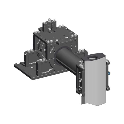
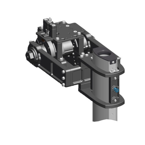
The MegaTower OTS (Over-The-Side) Mount is a heavy-duty, universal sonar mounting solution engineered for professional hydrographic survey operations. Designed for flexibility, durability, and stability, the MegaTower is ideal for deploying multibeam echosounders, sub-bottom profilers, USBL systems, and other sonar instruments on vessels of opportunity or dedicated survey platforms.
-
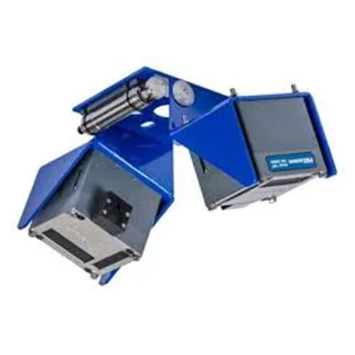 Dual head mounting bracket for 2020 MBES.
 -
 Onsite Installation, Integration & Training Services Onsite support to provide assistance with installation and integration and includes crew training. Rate charged for three (3) days onsite and two (2) half travel time. Does not include travel expenses.
 -
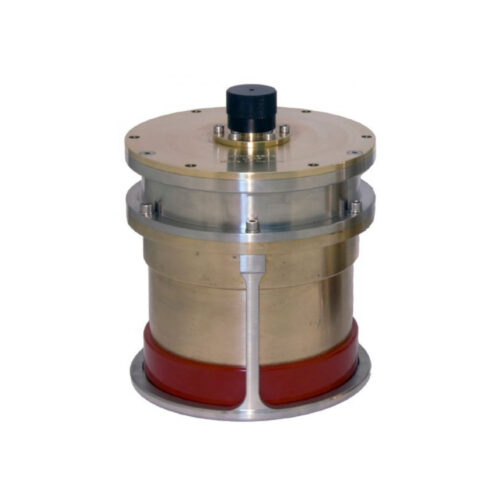
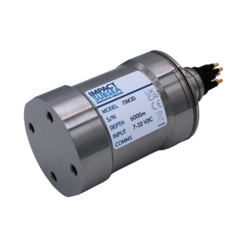 Impact Subsea ISM3D Motion Sensor, Titanium 6k Rated Equipment rental to supply Underwater Attitude and Heading Reference System (AHRS) with Titanium or Acetal housing and selectable Inertial Mode. Comes with 0.5-meter interface whip, USB drive with SeaView configuration software and user manual, quick start guide, and transit case.
 -
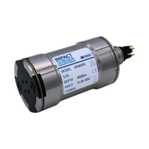 Impact Subsea ISD4000 Depth Sensor Equipment rental to supply an Underwater depth (pressure) and temperature sensor with titanium housing and integrated AHRS (roll, pitch, heading sensor). Comes with 0.5-meter interface whip, USB drive with SeaView configuration software and user manual, quick start guide, and transit case. Pressure rating: 300dBar
 -
Geometrics Telemetry MUX Equipment rental to supply telemetry bottle, topside power supply, and 15m deck cable
-
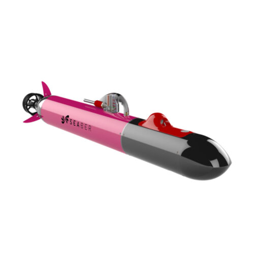 SEABER YUCO-CTD with other options available • INX Navigation system • With DVL (option) • SEAPLAN Software • Embedded rechargeable batteries (NiMh 250Wh) • SEACOMM • Field case and accessories
 -
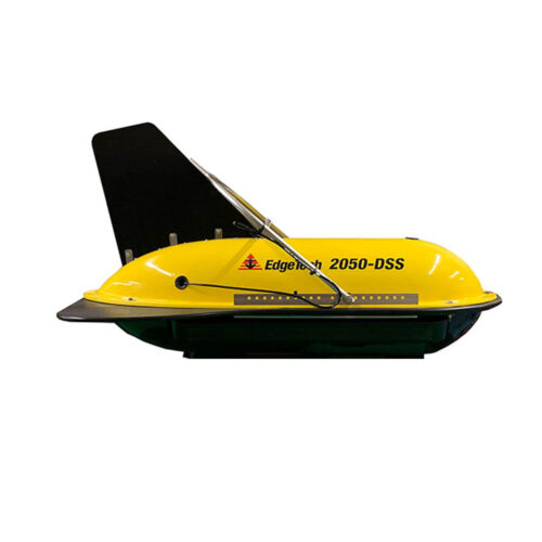
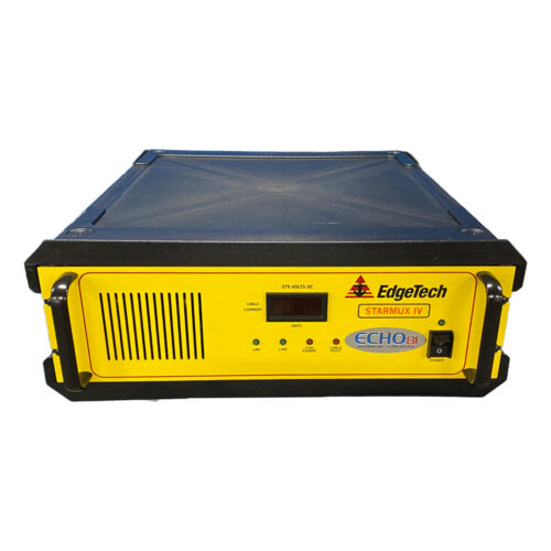 EdgeTech Starmux IV Interface Digital Interface for use with EdgeTech 4205/2050 Series towfish and customer supplied PC Full version of DISCOVER software available for customer download
 -
 Subscription or Perpetual based license
 -
 Subscription or Perpetual based license
 -
Included Features
- 24-bit SLF full waveform data acquisition / Innomar "SES3" data format
- Multi-ping mode for maintaining a high pulse rate in deep waters
- Multi-frequency signals
- SESWIN basic remote-control via COM / UDP (e.g. line start/stop, line name)
-
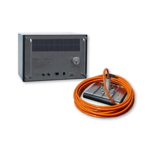
Included Features
- Heave / Roll (or Pitch) beam stabilization
- 16-bit SLF full waveform data acquisition (sub-bottom data) / Innomar "RAW" data format
- 24-bit SLF full waveform data acquisition / Innomar "SES3" data format
- Multi-ping mode for maintaining a high pulse rate in deep waters
- Multi-frequency signals
- LFM chirp (5 – 15 kHz)
- SESWIN basic remote-control via COM / UDP (e.g. line start/stop, line name)
- external AC power adapter (100–240 V AC)
-
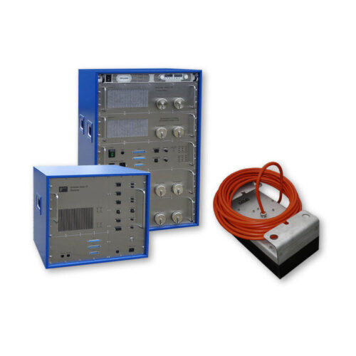
Included Features
- Heave, Roll and Pitch beam stabilization
- 24-bit SLF full waveform data acquisition / Innomar "SES3" data format
- Multi-ping mode for maintaining a high pulse rate in deep waters
- Multi-frequency signals
- LFM chirp (full SLF band)
- Barker coded pulses for safe bottom track also in multi-ping modes
- Linear sub-bottom profiler / SBES echosounder mode (12/15/18 kHz CW and 12 – 18 kHz FM chirp pulses)
- Bottom slope control
- KVM extender for remote control
- SESWIN basic remote-control via COM / UDP (e.g. line start/stop, line name)
- Transducer frame with integrated shock absorbers for hull-mounting
-
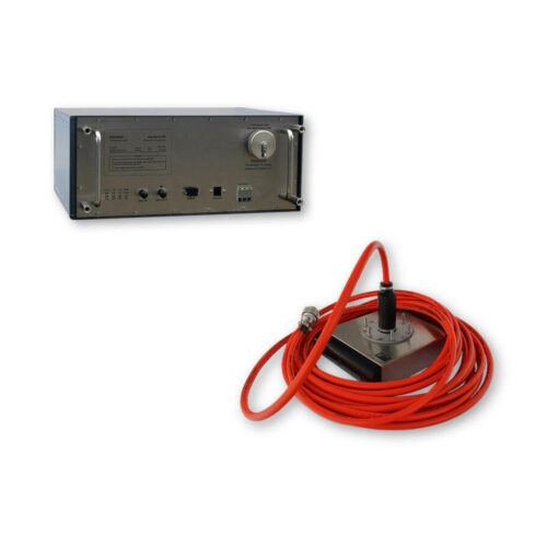
Included Features
- Heave / Roll (or Pitch) beam stabilization
- 16-bit SLF full waveform data acquisition (sub-bottom data) / Innomar "RAW" data format
- 24-bit SLF full waveform data acquisition / Innomar "SES3" data format
- Multi-ping mode for maintaining a high pulse rate in deep waters
- Multi-frequency signals
- LFM chirp (5 – 15 kHz)
- SESWIN basic remote-control via COM / UDP (e.g. line start/stop, line name)
-
Included Features
- Roll or Pitch beam stabilization
- 24-bit SLF full waveform data acquisition / Innomar "SES3" data format
- Multi-ping mode for maintaining a high pulse rate in deep waters
- Multi-frequency signals
- LFM chirp (5 – 15 kHz)
- SESWIN basic remote-control via COM / UDP (e.g. line start/stop, line name)
- external AC power adapter (100–240 V AC)
-
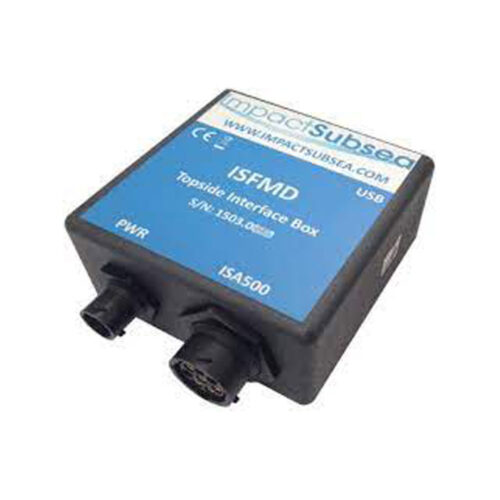 Impact Subsea ISFMD System Topside Interface Box
 -
 Impact Subsea ISFMD System Software License
 -
 Impact Subsea ISFMD System ROV Only System ROV Only System
 -
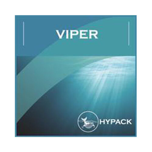 HYPACK VIPER: Visualization of environmental sensor data. Choose from over 50 sensor variables and view them in profile, gradient or spreadsheet view.
Contact us at +1 (706) 522-3022
TOP NEWS!
481 S. Jackson Street
Hartwell, GA 30643
Shop
Your account
Stay Connected
Explore the latest updates, product releases, and subsea technology insights from ECHO81.