-
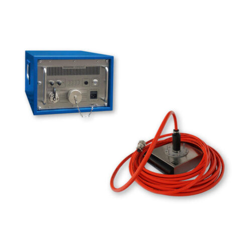 Innomar Compact SubBottom Profiler Equipment rental to supply an Innomar Compact Sub-Bottom Profiler. Comes with topside interface, pole mountable transducer with built in 20-meter deck cable, accessory kit, SES-WIN control software, mounting hardware, and transit cases.
 -
 Kongsberg M3 Sonar HF (Rental) The M3 Sonar HF is a high-frequency sonar with imaging and profiling modes. It is an impressive upgrade to the original M3 Sonar, with an all-titanium construction and two-hundred percent higher resolution.
 -
Kongsberg M3 Sonar HF The M3 Sonar HF is a high-frequency sonar with imaging and profiling modes. It is an impressive upgrade to the original M3 Sonar, with an all-titanium construction and two-hundred percent higher resolution.
-
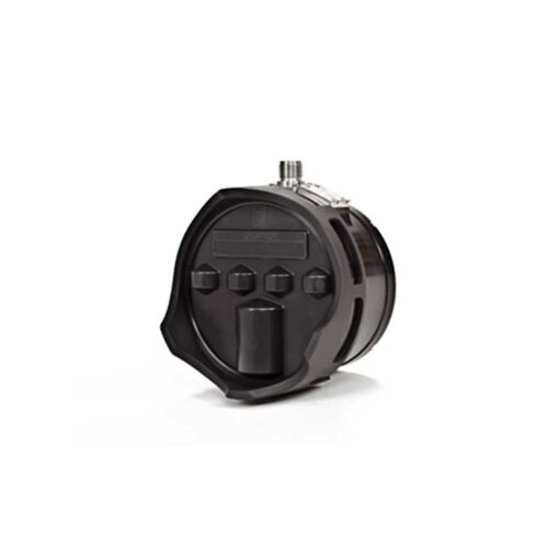
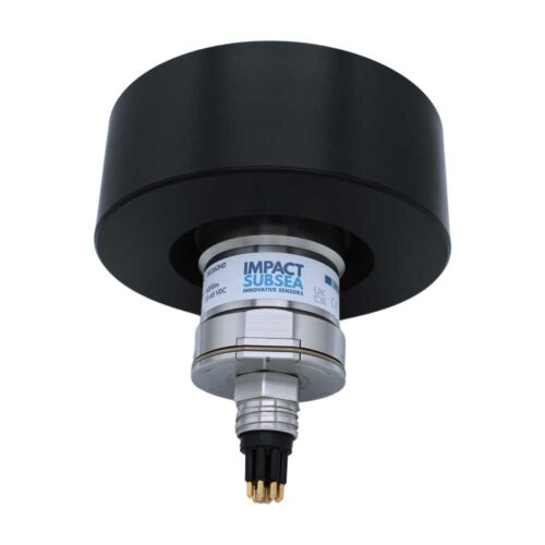 Impact Subsea ISS360 Compact Imaging Sonar Equipment to supply a small and portable Compact Imaging scanning sonar system. Comes with a titanium instrument, 0.5-meter interface whip, USB drive with SeaView configuration software and user manual, quick start guide, and transit case.
 -
Impact Subsea ISS360 Compact Imaging Sonar Equipment rental to supply a small and portable Compact Imaging scanning sonar system. Comes with a titanium instrument, 0.5-meter interface whip, USB drive with SeaView configuration software and user manual, quick start guide, and transit case.
-
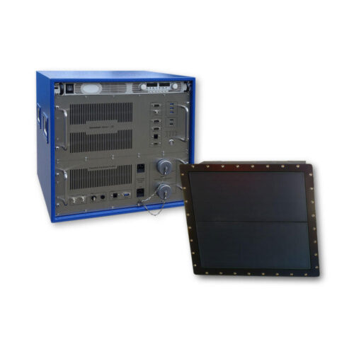
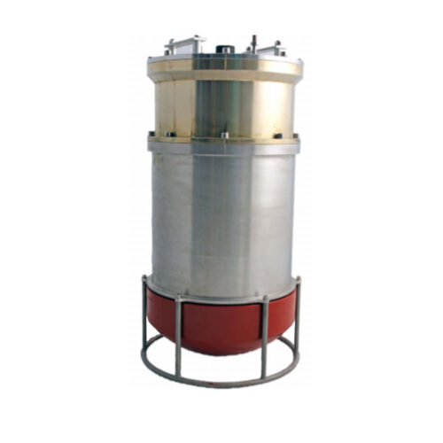
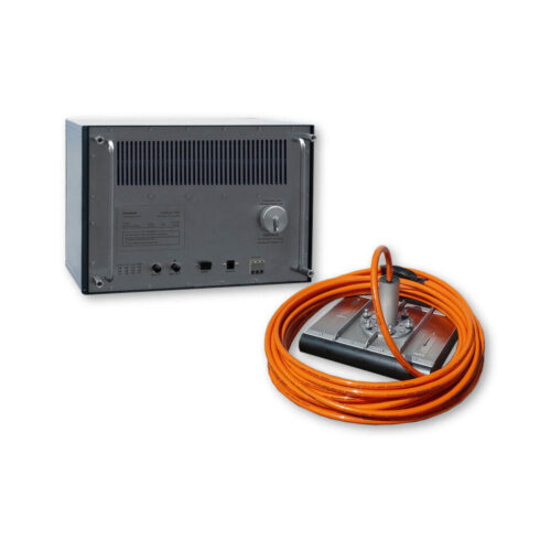 Equipment rental to supply an Innomar Medium-100 USV Sub-Bottom Profiler. Comes with topside interface with OUT PC, pole mountable transducer with 15-meter deck cable, accessory kit, SES-WIN control software, mounting hardware, and transit cases.
 -
Included Features
- Heave / Roll beam stabilization
- 24-bit SLF full waveform data acquisition / Innomar "SES3" data format
- Multi-ping mode for maintaining a high pulse rate in deep waters
- Multi-frequency signals
- LFM chirp (2 – 7 kHz)
- KVM extender for remote control
- SESWIN basic remote-control via COM / UDP (e.g. line start/stop, line name)
- Transducer frame with integrated shock absorbers for hull-mounting
-
 HYPACK SURVEY & HYSWEEP: is the recommended combination when outfitting a multibeam survey vessel, ASV or USV. SURVEY & HYSWEEP supports logging any kind of data supported by HYPACK software products (MAX and HYSWEEP). It also supports data processing; however final product generation is not supported with this license.
 -
 SonarWiz with other available options
 -
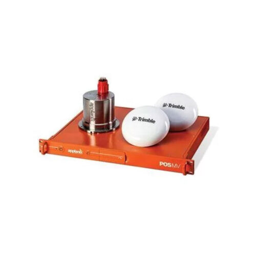
 Maximize your ROI with Applanix® POS MV WaveMaster. WaveMaster is a user‑friendly, turnkey system designed and built to provide accurate attitude, heading, heave, position, and velocity data of your marine vessel and onboard sensors. Applanix POS MV blends GNSS data with angular rate and acceleration data from an IMU and heading from GNSS Azimuth Measurement System (GAMS) to produce a robust and accurate full six degrees of freedom Position and Orientation solution. All Applanix POS MV models are designed for use with multibeam sonar systems, enabling adherence to IHO (International Hydrographic Survey) standards on sonar swath widths of greater than ± 75 degrees under all dynamic conditions.
 -
 Maximize your ROI with Applanix® POS MV OceanMaster. OceanMaster is a user-friendly, turnkey system designed and built to provide accurate attitude, heading, heave, position, and velocity data of your marine vessel and onboard sensors. Applanix POS MV blends GNSS data with angular rate and acceleration data from an IMU and heading from GNSS Azimuth Measurement System (GAMS) to produce a robust and accurate full six degrees of freedom Position and Orientation solution. All Applanix POS MV models are designed for use with multibeam sonar systems, enabling adherence to IHO (International Hydrographic Survey) standards on sonar swath widths of greater than ± 75 degrees under all dynamic conditions.
 -
 Kongsberg 352P MGC R3 USBL System Portable system designed for tracking ROV's, towfish, divers and other subsea objects at several thousand meters range. The system operates in SSBL mode where it measures the distance and direction to subsea transponders and computes a 3D position in local coordinates or in geographical coordinates. Built-in MGC RT inertial measurement unit for roll/pitch and heading compensation. No need for calibration to determine roll, pitch and heading alignments.
Contact us at +1 (706) 522-3022
TOP NEWS!
481 S. Jackson Street
Hartwell, GA 30643
Shop
Your account
Stay Connected
Explore the latest updates, product releases, and subsea technology insights from ECHO81.